You Won’t Believe These Queenstown Viewpoints — Hiking Magic Uncovered
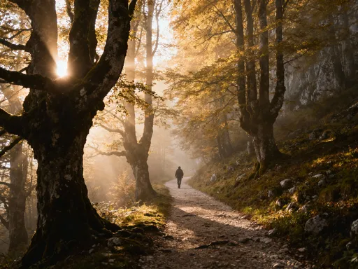
If you’ve ever dreamed of hiking trails that lead to jaw-dropping panoramas, Queenstown, New Zealand is pure gold. I hit the tracks at dawn, and within hours, I was staring at landscapes so sharp and clear they felt unreal—crystal-blue lakes, jagged peaks, and valleys carved by ancient glaciers. This isn’t just hiking; it’s like walking through a living postcard. Let me show you the viewpoints that left me speechless—and why they’re worth every uphill step.
Why Queenstown Is a Hiker’s Dream Destination
Queenstown stands as one of the most breathtaking alpine destinations in the Southern Hemisphere, drawing hikers from around the world with its dramatic scenery and well-structured trail system. Nestled on the shores of Lake Wakatipu and surrounded by towering mountain ranges, the town sits in a geological masterpiece shaped by glacial forces over millions of years. These ancient ice flows carved deep valleys and left behind steep ridgelines, creating a landscape where nearly every elevated path delivers a commanding view. The result is a hiking environment that balances raw natural beauty with thoughtful infrastructure, making it accessible without sacrificing adventure.
What sets Queenstown apart is its ability to cater to a wide range of hikers. Whether you’re a casual walker looking for a gentle climb with rewarding vistas or an experienced trekker seeking a full-day challenge, the region offers something meaningful. Trails are clearly marked, maintained by New Zealand’s Department of Conservation (DOC), and often include informative signage about local flora, geology, and Māori heritage. This attention to detail enhances the experience, allowing visitors to engage more deeply with the environment. Additionally, the compact size of the town means many trailheads are just a short walk or drive away, reducing travel time and maximizing time on the trail.
The climate further enhances the hiking experience. With over 2,000 hours of sunshine annually, Queenstown enjoys favorable conditions for outdoor activity, especially during the Southern Hemisphere’s spring through autumn months. Mornings are typically crisp and clear, offering the best visibility for panoramic views across the lake and mountains. While weather can shift quickly in alpine zones, local forecasts are reliable, and DOC updates are regularly posted online and at trailheads, helping hikers make informed decisions. This combination of natural splendor, accessibility, and safety makes Queenstown not just a destination for thrill-seekers, but a sanctuary for those who seek connection with nature.
Moreover, the region’s biodiversity adds another layer of richness to the hiking experience. Native beech forests line many trails, their broad canopies filtering sunlight and sheltering a variety of bird species. The call of the tūī, the flash of a fantail, or the occasional sighting of a kea—the world’s only alpine parrot—can turn a simple walk into a memorable wildlife encounter. These moments of quiet connection, paired with sweeping vistas, contribute to Queenstown’s reputation as a place where physical effort is met with profound emotional reward. It’s no wonder that so many return year after year, chasing the clarity that only mountain air and open skies can provide.
Ben Lomond Track: The Classic Ascent with a Reward Like No Other
Among Queenstown’s many trails, the Ben Lomond Track stands as a crown jewel—a challenging yet deeply rewarding ascent that delivers one of the most spectacular 360-degree views in the region. Starting near the Skyline Gondola base, the trail begins with a steep climb through dense native forest, where beech and tussock give way to alpine shrubs as elevation increases. The full summit hike covers approximately 10 kilometers round-trip with an elevation gain of around 1,438 meters, making it a full-morning or early-afternoon commitment for most hikers. While strenuous, the path is well-graded and clearly marked, allowing confident hikers of moderate fitness to reach the top with proper preparation.
The journey unfolds in distinct stages, each offering its own visual rewards. The first section, known as the Fisherman’s Path, winds gently alongside Lake Wakatipu before joining the steeper Ben Lomond Trail. As the incline increases, hikers pass through a subalpine zone where mountain flax and hardy herbs cling to rocky outcrops. The saddle—a broad, windswept plateau at about 1,100 meters—serves as a natural rest point and already provides sweeping views of Queenstown, the lake, and The Remarkables mountain range. Many choose to stop here, but those who push forward are rewarded with an additional 30 to 45 minutes of climbing to the true summit.
Reaching the summit of Ben Lomond is nothing short of transformative. On a clear day, the panorama stretches for miles in every direction: Lake Wakatipu snakes through the valley like a ribbon of liquid silver, framed by Cecil Peak, Walter Peak, and the distant Humboldt Mountains. To the southeast, the dramatic spires of The Remarkables rise sharply against the sky, their jagged ridgelines a reminder of the tectonic forces that shaped this land. Looking west, the Humboldt and Darran Mountains extend into Fiordland National Park, a vast wilderness area that includes Milford Sound. The sense of elevation—of being above the world—is both humbling and exhilarating.
Because of its exposure, the summit can be extremely windy, even on calm days at lower elevations. Hikers are advised to bring windproof layers and to check weather conditions before departure. Early morning starts are ideal, not only for cooler temperatures but also for softer light and fewer crowds. Photographers will appreciate the golden glow that bathes the landscape at sunrise, while solo hikers often describe a profound sense of solitude and clarity at this height. Ben Lomond is more than a physical challenge; it’s a journey into stillness, offering a rare chance to see Queenstown not as a bustling resort town, but as a tiny settlement nestled within an immense and ancient landscape.
Queenstown Hill: A Surprisingly Powerful Perspective Close to Town
For those seeking a meaningful hike without a full-day commitment, Queenstown Hill offers an accessible yet deeply moving experience just minutes from the town center. The trailhead begins near the end of Brecon Street, making it one of the most convenient elevated viewpoints in the region. At just 4.4 kilometers round-trip with an elevation gain of 330 meters, the hike is suitable for families, casual walkers, and visitors with limited time. Yet, despite its proximity and moderate difficulty, the view from the top carries an emotional weight that often surprises first-time hikers.
The path climbs steadily through open grassland and patches of regenerating native bush, offering gradual reveals of the surrounding landscape. Within the first 15 minutes, hikers gain enough height to see across Lake Wakatipu, with the town of Queenstown spread out below like a model village. The trail is well-maintained, with wooden steps in steeper sections and clear signage at junctions. As you ascend, the air grows cooler and quieter, the sounds of traffic fading into the rustle of wind through the tussock. This transition—from urban to alpine—is part of what makes the hike so powerful.
At the summit, the iconic “Peace” monument stands as a stone cairn inscribed with messages of harmony in multiple languages. Installed in 2000 as part of a global peace initiative, the monument adds a layer of meaning to the experience, inviting reflection alongside sightseeing. From this vantage point, the entire sweep of Queenstown unfolds: the lake curving around Frankton Arm, the Remarkables glowing in the afternoon sun, and the distant peaks of the Richardson Range. On clear days, the view extends to Cecil Peak and beyond, creating a sense of being both close to town and far above its daily rhythms.
What makes Queenstown Hill especially valuable is its accessibility in all seasons. In spring, wildflowers dot the slopes; in autumn, golden grasses ripple in the wind. Even in winter, when higher trails may be snow-covered or icy, Queenstown Hill often remains passable with proper footwear. It’s also a popular spot for sunrise hikes, when the first light paints the mountains in soft pinks and oranges. For families with children or those testing their hiking stamina, this trail provides a perfect introduction to Queenstown’s alpine beauty—proof that you don’t need to climb for hours to feel the magic of the mountains.
Kepler Track’s Luxmore Hut Lookout: A Glimpse into Backcountry Majesty
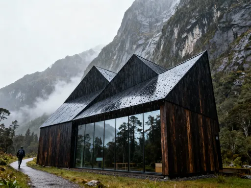
While the full Kepler Track is renowned as one of New Zealand’s Great Walks—a three-day loop through diverse ecosystems—many visitors don’t realize that a portion of this legendary trail is accessible as a rewarding day hike. The Luxmore Hut Lookout, perched at 1,070 meters, offers a taste of backcountry grandeur without the need for a multi-day commitment. Reached via the Luxmore Caves route from Te Anau Downs, this section delivers dramatic limestone bluffs, rare cave formations, and panoramic views over Lake Te Anau and the Kepler Mountains.
The hike to Luxmore Hut begins with a steady climb through red beech forest, gradually emerging into alpine terrain marked by tussock grasslands and rocky outcrops. One of the most unique features along the way is the Luxmore Caves—small limestone caverns formed by millennia of water erosion. While entry is discouraged for safety reasons, viewing them from the trail offers a fascinating glimpse into the region’s geological history. The path is well-constructed with boardwalks in wetter sections and sturdy steps on steeper grades, reflecting the high standard of DOC-maintained Great Walks.
Upon reaching the Luxmore Hut area, hikers are greeted with one of the most expansive views in the region. To the west, Lake Te Anau stretches like a vast mirror, its many fiords cutting deep into the surrounding wilderness. The Murchison Mountains rise in the distance, home to rare species like the endangered takahē. To the east, the sharp ridgelines of the Kepler Range stand in stark contrast to the softer curves of the surrounding hills. On clear days, the view extends all the way to Mount Luxmore itself, its summit often dusted with snow even in summer.
Birdlife is another highlight of this hike. The kea, New Zealand’s mischievous alpine parrot, is frequently spotted around the hut, drawn by the presence of hikers and the abundance of insects in the area. Their bright green plumage and curious nature make them a favorite among visitors, though DOC advises against feeding them to protect both birds and people. Other species, such as the rock wren and the New Zealand pipit, can also be seen flitting through the tussock. The combination of geological wonder, sweeping vistas, and wildlife interaction makes the Luxmore Hut Lookout a standout experience—one that captures the essence of Fiordland’s untouched beauty.
Hidden Gem: The Lady Falls Track & Its Secret Valley View
Tucked behind Queenstown and often overlooked by international visitors, the Lady Falls Track is a quiet treasure that blends waterfall charm with elevated valley perspectives. Starting near the base of the Skyline access road, the trail climbs steadily through regenerating native bush, offering a peaceful alternative to busier routes. At just 5.4 kilometers round-trip with a moderate elevation gain, it strikes a perfect balance between effort and reward, making it ideal for hikers who want solitude and beauty without extreme exertion.
The first part of the track follows an old service road, gradually ascending through pine and beech forest. As the path narrows and turns into a proper hiking trail, it begins to reveal sudden clearings with sweeping views over the eastern side of Queenstown. From these vantage points, hikers can see across the valley to Mount Crichton and the Richardson Range, with Lake Wakatipu shimmering in the distance. The relative quiet of this trail—especially on weekday mornings—creates a meditative atmosphere, broken only by the sound of wind and the occasional bird call.
The highlight of the hike is, of course, Lady Falls itself—a delicate cascade that tumbles down a moss-covered cliff face after heavy rain. While the waterfall is most impressive in spring or after rainfall, the surrounding area remains scenic year-round, with ferns and native shrubs creating a lush, green amphitheater. A small viewing platform allows safe observation, and the mist from the falls often carries a refreshing coolness, even on warm days. Beyond the falls, the trail continues to a high point that offers one of the best panoramic views of the valley, yet few hikers venture this far, preserving its sense of discovery.
What makes Lady Falls Track truly special is its sense of intimacy. Unlike the broad, open summits of Ben Lomond or Queenstown Hill, this trail feels personal—a hidden corridor through the mountains where nature feels close and immediate. It’s a favorite among locals, who return again and again for its peaceful energy and seasonal transformations. Whether you’re hiking to stretch your legs after a long flight or seeking a quiet moment of reflection, Lady Falls offers a gentle reminder that some of the best views are found off the beaten path.
Practical Tips for Maximizing Your Hiking Experience
To fully enjoy Queenstown’s hiking trails, a bit of preparation goes a long way. Starting early—ideally between 6:00 and 7:30 a.m.—is one of the most effective strategies. Mornings offer the clearest skies, the softest light for photography, and the greatest chance of solitude on popular trails like Ben Lomond. It also allows hikers to complete their journey before afternoon winds or cloud buildup affect visibility, especially at higher elevations.
Proper gear is essential, regardless of trail length. Even on short hikes, temperatures can vary dramatically between the valley floor and mountain summits. Layered clothing—including a moisture-wicking base layer, an insulating mid-layer, and a windproof outer shell—is highly recommended. Sturdy hiking boots with good grip are crucial, particularly on rocky or uneven terrain. Sun protection is equally important; New Zealand’s UV levels are intense, so a wide-brimmed hat, sunglasses, and SPF 30+ sunscreen should never be left behind. Carrying at least one liter of water per person helps prevent dehydration, especially on longer climbs.
Before heading out, always check the latest DOC alerts for trail closures, weather warnings, or avalanche risks. These updates are available on the official Department of Conservation website and at visitor centers in Queenstown and Te Anau. Trail conditions can change due to rain, snow, or maintenance work, so staying informed ensures both safety and enjoyment. Additionally, while most trails have clear signage, carrying a basic map or using an offline hiking app can provide peace of mind, especially in areas with limited cell service.
Transportation to trailheads is generally straightforward. Queenstown Hill and Ben Lomond can be reached on foot or by taxi from the town center. For more remote trails like the Luxmore Caves, a personal vehicle or guided shuttle is necessary. Parking is available at major trailheads, though spaces can fill quickly during peak season (December to February). Consider visiting in the shoulder seasons—November or March—for fewer crowds and mild weather. Finally, remember to practice Leave No Trace principles: pack out all trash, stay on marked paths, and respect wildlife. These small actions help preserve Queenstown’s natural beauty for future generations.
Why These Viewpoints Change the Way You See Nature
Standing atop a mountain in Queenstown, looking out over a landscape shaped by ice, time, and tectonic force, does more than satisfy a desire for beautiful scenery—it shifts something within. The physical effort of climbing, breath heavy and legs burning, makes the moment of arrival feel earned. And when the view finally unfolds—the lake glinting below, the peaks rising in every direction—there’s a stillness that transcends the visual. It’s not just about seeing nature; it’s about feeling connected to it.
These viewpoints offer more than postcard moments; they provide perspective in the deepest sense. From above, the concerns of daily life—traffic, deadlines, noise—shrink into insignificance. The vastness of the landscape puts things into proportion, reminding us of our small but meaningful place within the natural world. This sense of clarity is one of the most powerful benefits of hiking, one that lingers long after the hike is over. Many hikers describe feeling calmer, more centered, and more grateful after spending time in the mountains.
Moreover, the act of moving through nature—step by step, breath by breath—creates a rhythm that soothes the mind. Unlike passive sightseeing, hiking engages the body and focus, creating a form of moving meditation. The trail demands attention: where to place your foot, how to pace your climb, when to pause and drink water. This mindfulness, combined with the beauty of the surroundings, fosters a deep sense of presence. You’re not just visiting nature; you’re moving through it, part of its flow.
For families, these hikes offer shared experiences that strengthen bonds. Children learn resilience by completing a climb; couples reconnect without distractions; friends celebrate milestones on mountain tops. And for solo hikers, the silence and space provide rare opportunities for reflection and renewal. Queenstown’s viewpoints are not just destinations—they are invitations to slow down, look closely, and feel the quiet power of the earth. In a world that moves too fast, these trails offer something essential: a chance to remember what it means to be truly alive.